


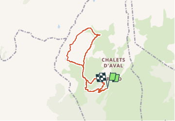

8.4 km | 11.7 km-effort


User


FREE GPS app for hiking
 SityTrail
IGN / Geographical institutes
SityTrail World
The world is yours!
Trail Walking of 14.5 km to be discovered at Auvergne-Rhône-Alpes, Savoy, La Plagne-Tarentaise. This trail is proposed by Maryma.
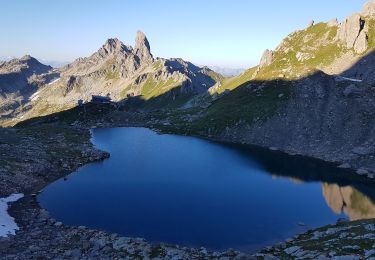
Lac de la Portette 2333m
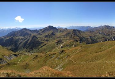
Col de la Charbonnière 2494m
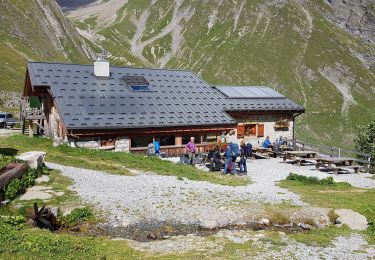
Refuge communal de la Balme
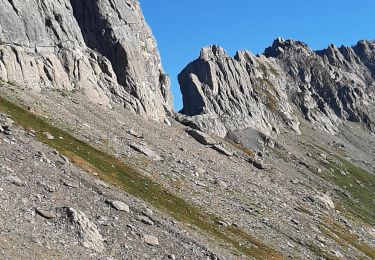
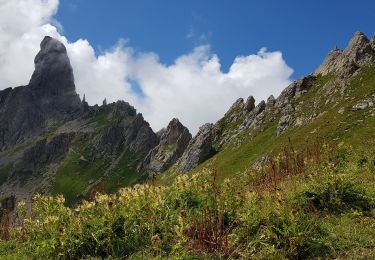
Belle vue sur Pietra Menta
Option : monter jusqu'au refuge du Presset (2h AR)
Attention : au km1 environ à une intersection, il faudrait prendre le chemin en face. Il y a eu un glissement de terrain. Soit prendre dans ce même glissement (trace visible mais très raide) soit partir sur la droite pour revenir sur le sentier.
Au retour, j'ai pris le sentier des bergers après le chalet du Mont Rosset (Beaufort à vendre en début de saison). Il est très très pentu un certain temps. Si quelques appréhensions, prendre le chemin de l'aller.

Walking

Walking

Walking

Snowshoes
Walking
Walking
Walking
Walking
Walking